الفرق بين النسختين بتاع: «نورثهامبتون»
تم حذف المحتوى تمت إضافة المحتوى
جديده |
image |
||
| سطر 2: | سطر 2: | ||
|name = نورثهامپتون |
|name = نورثهامپتون |
||
|settlement_type = [[Town]], [[borough]] and [[non-metropolitan district]] |
|settlement_type = [[Town]], [[borough]] and [[non-metropolitan district]] |
||
|image_skyline = Northampton |
|image_skyline = Northampton Guildhall01.JPG |
||
|imagesize = |
|imagesize = |
||
|image_caption = |
|||
|image_caption = From top left: Skyline of Northampton town centre from Delapre Park; [[All Saints' Church, Northampton|All Saints' Church]]; [[Northampton Guildhall]]; the [[National Lift Tower]]; [[Delapré Abbey]]; [[Abington Park]]; Market Square. |
|||
|image_blank_emblem= |
|image_blank_emblem= |
||
|blank_emblem_type = |
|blank_emblem_type = |
||
تعديلات من 19:47، 16 سبتمبر 2013
نورثهامپتون | |
|---|---|
 | |
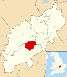
 Northampton shown within Northamptonshire | |
| Sovereign state | United Kingdom |
| Constituent country | England |
| Region | East Midlands |
| Ceremonial county | Northamptonshire |
| Admin HQ | Northampton Guildhall |
| Town charter | 1189 |
| Incorporated | 1835 |
| Government | |
| • Type | Non-metropolitan district |
| • Governing body | Northampton Borough Council |
| • Leader | David Mackintosh (Con) |
| • Mayor | Les Marriott (Lab) |
| • MPs | Brian Binley (Con) Michael Ellis (Con) Andrea Leadsom (Con) |
| Area | |
| • Total | 31.18 sq mi (80.76 km2) |
| Population (2008 est.) | |
| • Total | 212,500 (Ranked 73rd) |
| • Density | 6,810/sq mi (2,631/km2) |
| • Ethnicity | 84.5% White 6.4% South Asian 5.1% Black 3.2% Mixed Race 0.3% Arab 0.5% Other |
| Demonym | Northamptonian |
| Time zone | UTC0 (GMT) |
| • Summer (DST) | UTC+1 (BST) |
| Postcode area | |
| Area code | 01604 |
| ISO 3166-2 | GB-NTH |
| ONS code | 34UF (ONS) E07000154 (GSS) |
| NUTS 3 | UKF24 |
| Website | northampton.gov.uk |
نورثهامبتون مدينه ف انجلترا ف المملكه المتحده
