
ملف:Kerala locator map.svg

حجم معاينة PNG لذلك الملف ذي الامتداد SVG: 494 × 600 بكسل. الأبعاد التانيه: 198 × 240 بكسل | 395 × 480 بكسل | 632 × 768 بكسل | 843 × 1,024 بكسل | 1,687 × 2,048 بكسل | 1,340 × 1,627 بكسل.
الصوره الاصليه (ملف SVG، اساسا 1,340 × 1,627 بكسل، حجم الملف: 151 كيلوبايت)
| العنوان |
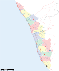
Kerala locator map |
||
| الوصف |
Locator map for the state of w:Kerala |
||
| تاريخ | |||
| مصدر |
عمل شخصى |
||
| الصانع |
|
||
| سماح (إعادة استخدام الملف ده) |
أنا، صاحب حقوق التأليف والنشر لهذا العمل، أنشر هذا العمل تحت الرخصة التالية: الملف ده مترخص حسب رخصة المشاع الإبداعى نسبة المصنف للى مألفه - المشاركة بالمثل 3.0 العامه
|
||
| Geotemporal data | |||
| تاريخ التمثيل | النصف الثاني من القرن 20 و القرن 21 | ||
| Georeferencing | If inappropriate please set warp_status = skip to hide. | ||
| Archival data | |||
| ملاحظات | Part of WikiProject India Maps | ||
تاريخ الفايل
اضغط على الساعه/التاريخ علشان تشوف الفايل زى ما كان فى الوقت ده.
| الساعه / التاريخ | صورة صغيرة | ابعاد | يوزر | تعليق | |
|---|---|---|---|---|---|
| دلوقتي | 14:53، 13 ابريل 2007 | | 1,340 × 1,627 (151 كيلوبايت) | Planemad | correcting crop |
| 14:52، 13 ابريل 2007 |  | 1,591 × 1,975 (152 كيلوبايت) | Planemad | ||
| 18:09، 9 ابريل 2007 |  | 1,323 × 1,607 (68 كيلوبايت) | Planemad | {{WikiProject_India_Maps |Title=Kerala locator map |Description=Locator map for the state of [w:Kerala]] |Source= [http://keralapolice.org/map/keralamap.html Kerala Police - Map of Kerala], |Date=April 2007 |Author=w:user:Planemad }} [[Category:Wiki |
استخدام الفايل
مافيش صفحات بتوصل للفايل ده.
استخدام الملف العام
الويكيات التانيه دى بتستخدم الفايل ده:
- الاستخدام ف awa.wikipedia.org
- الاستخدام ف bo.wikipedia.org
- الاستخدام ف de.wikipedia.org
- الاستخدام ف dv.wikipedia.org
- الاستخدام ف en.wikipedia.org
- الاستخدام ف es.wikipedia.org
- الاستخدام ف fa.wikipedia.org
- الاستخدام ف gd.wikipedia.org
- الاستخدام ف gu.wikipedia.org
- الاستخدام ف hi.wikipedia.org
- कोल्लम जिला
- मुन्नार
- मालाबार
- कोवलम
- पुथूर
- कुमारकोम
- साँचा:केरल के लोकसभा निर्वाचन क्षेत्र
- मलप्पुरम लोक सभा निर्वाचन क्षेत्र
- आलप्पुष़ा लोक सभा निर्वाचन क्षेत्र
- आलत्तूर लोक सभा निर्वाचन क्षेत्र
- आट्टिंगल लोक सभा निर्वाचन क्षेत्र
- चालकुडी लोक सभा निर्वाचन क्षेत्र
- एर्णाकुलम लोक सभा निर्वाचन क्षेत्र
- इदुक्की लोक सभा निर्वाचन क्षेत्र
- कन्नूर लोक सभा निर्वाचन क्षेत्र
- कासरगोड लोक सभा निर्वाचन क्षेत्र
- कोल्लम लोक सभा निर्वाचन क्षेत्र
- कोट्टयम लोक सभा निर्वाचन क्षेत्र
- कोष़िक्कोड लोक सभा निर्वाचन क्षेत्र
- मावेलिक्करा लोक सभा निर्वाचन क्षेत्र
- वयनाड लोक सभा निर्वाचन क्षेत्र
- पालक्काड लोक सभा निर्वाचन क्षेत्र
- पत्तनमतिट्टा लोक सभा निर्वाचन क्षेत्र
- पोन्नानी लोक सभा निर्वाचन क्षेत्र
- तिरुवनन्तपुरम लोक सभा निर्वाचन क्षेत्र
- त्रिश्शूर लोक सभा निर्वाचन क्षेत्र
- वडकरा लोक सभा निर्वाचन क्षेत्र
- केरल के मुख्यमंत्रियों की सूची
- الاستخدام ف incubator.wikimedia.org
- الاستخدام ف ka.wikipedia.org
- الاستخدام ف mai.wikipedia.org
- الاستخدام ف ml.wikipedia.org
اعرض استخدام عام اكتر للملف ده.