
ملف:T J OBrien Lock and Dam.jpg

حجم البروفه دى: 800 × 533 بكسل. الأبعاد التانيه: 320 × 213 بكسل | 640 × 427 بكسل | 1,024 × 683 بكسل | 1,500 × 1,000 بكسل.
الصوره الاصليه (1,500 × 1,000 بكسل حجم الفايل: 279 كيلوبايت، نوع MIME: image/jpeg)
| وصف |
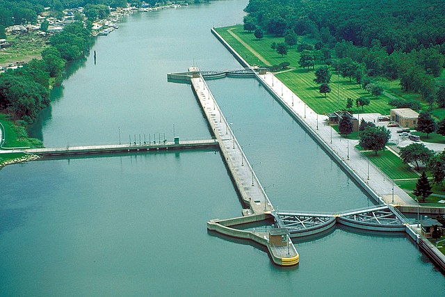
English: Aerial view of T.J. O’Brien Lock and Dam on the Calumet River, which is part of the Illinois Waterway. The dam is situated at river mile 326.5 on the Waterway (326.5 river miles up from the Mississippi River). T.J. O’Brien lock is the uppermost lock on the waterway, and there is not another barrier between the lock and Lake Michigan. There is very little elevation change in the lock, which serves mainly to regulate water flow from Lake Michigan into the waterway. The dam is located in Chicago, Illinois. |
|||
| تاريخ | ||||
| مصدر |
U.S. Army Corps of Engineers Digital Visual Library Image page Image description page Digital Visual Library home page |
|||
| مؤلف | Carol Arney, U.S. Army Corps of Engineers | |||
| سماح (إعادة استخدام الملف ده) |
|
|||
| الموقع | Chicago, Illinois, USA |
| موقع الكاميرا | | هذه وغيرها من الصور في مواقعها على: خريطة الشارع المفتوحة |
|---|
تاريخ الفايل
اضغط على الساعه/التاريخ علشان تشوف الفايل زى ما كان فى الوقت ده.
| الساعه / التاريخ | صورة صغيرة | ابعاد | يوزر | تعليق | |
|---|---|---|---|---|---|
| دلوقتي | 00:50، 3 ابريل 2007 | | 1,500 × 1,000 (279 كيلوبايت) | DanMS | {{Information | Description = {{en|Aerial view of T. J. O’Brien Lock and Dam on the Calumet River, which is part of the Illinois Waterway. The dam is situated at river mile 326 on the Waterway (326 river miles up from the Mississippi River). T.J. O� |
استخدام الفايل
ال1 صفحة دى فيها وصله للفايل ده:
استخدام الملف العام
الويكيات التانيه دى بتستخدم الفايل ده:
- الاستخدام ف ceb.wikipedia.org
- الاستخدام ف de.wikipedia.org
- الاستخدام ف en.wikipedia.org
- الاستخدام ف eo.wikipedia.org
- الاستخدام ف fr.wikipedia.org
- الاستخدام ف la.wikipedia.org
- الاستخدام ف lt.wikipedia.org
- الاستخدام ف www.wikidata.org