
ملف:PikiWiki Israel 16194 kiryat gat.jpg

حجم البروفه دى: 799 × 599 بكسل. الأبعاد التانيه: 320 × 240 بكسل | 640 × 480 بكسل | 1,024 × 768 بكسل | 1,280 × 960 بكسل | 1,682 × 1,262 بكسل.
الصوره الاصليه (1,682 × 1,262 بكسل حجم الفايل: 2.83 ميجابايت، نوع MIME: image/jpeg)
| وصف |
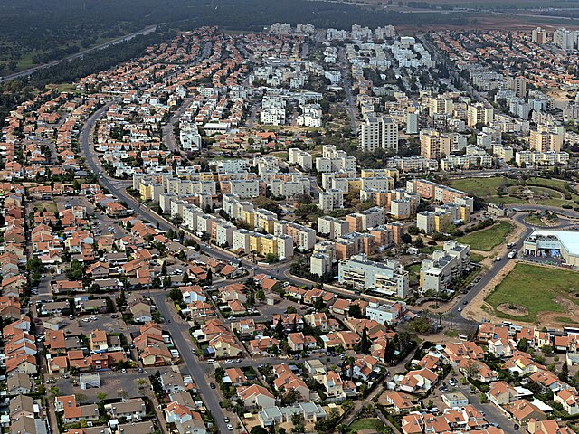
English: kiryat gat, Geography of Israel עברית: תצלום אווירי על הצד המערבי של העיר קרית גת, Original Image Name:תצלום אווירי, Location:קרית גת |
| تاريخ | قرابة 2010 |
| مصدر | Lehava Center Qiryat Gat via the PikiWiki - Israel free image collection project |
| مؤلف | ארכיון קרית גת |
| سماح (إعادة استخدام الملف ده) |
هذا الملف مُرخص تحت رخصة المشاع المبدع نسبة المصنف إلى مؤلفه 2.5 العامة نسبه ل: ארכיון קרית גת
|

|
This file has been submitted through the Israeli Pikiwiki project and uploaded here automatically.
The project is cooperation between the Israel Internet Association and Wikimedia Israel in an effort to promote the concept of free content on the Web, by creating an image collection of digital-format, good quality photographs, documenting events relating to the history of Israel, or depicting places of distinction in Israel and the Middle East. The Pikiwiki Project is managed from 2021 by the "Heritage Stones" group.
Please consider notifying the project before renaming or deleting this file. Further information about the project can be found on the commons-l mailing list.
|
تاريخ الفايل
اضغط على الساعه/التاريخ علشان تشوف الفايل زى ما كان فى الوقت ده.
| الساعه / التاريخ | صورة صغيرة | ابعاد | يوزر | تعليق | |
|---|---|---|---|---|---|
| دلوقتي | 13:13، 1 يناير 2012 | | 1,682 × 1,262 (2.83 ميجابايت) | Pikiwikisrael | {{Information |Description={{en|kiryat gat, Geography of Israel}} {{he|תצלום אווירי על הצד המערבי של העיר קרית גת, Original Image Name:תצלום אווירי, Location:קרית גת}} |Source=Lehava Center Qiryat Gat vi |
استخدام الفايل
ال1 صفحة دى فيها وصله للفايل ده:
استخدام الملف العام
الويكيات التانيه دى بتستخدم الفايل ده:
- الاستخدام ف ar.wikipedia.org
- الاستخدام ف ca.wikipedia.org
- الاستخدام ف ceb.wikipedia.org
- الاستخدام ف el.wikipedia.org
- الاستخدام ف en.wikipedia.org
- الاستخدام ف es.wikipedia.org
- الاستخدام ف fa.wikipedia.org
- الاستخدام ف fi.wikipedia.org
- الاستخدام ف he.wikipedia.org
- الاستخدام ف hi.wikipedia.org
- الاستخدام ف hy.wikipedia.org
- الاستخدام ف id.wikipedia.org
- الاستخدام ف ie.wikipedia.org
- الاستخدام ف it.wikipedia.org
- الاستخدام ف ja.wikipedia.org
- الاستخدام ف ka.wikipedia.org
- الاستخدام ف ko.wikipedia.org
- الاستخدام ف mn.wikipedia.org
- الاستخدام ف nl.wikipedia.org
- الاستخدام ف nn.wikipedia.org
- الاستخدام ف no.wikipedia.org
- الاستخدام ف pnb.wikipedia.org
- الاستخدام ف ru.wikipedia.org
- الاستخدام ف simple.wikipedia.org
- الاستخدام ف sr.wikipedia.org
- الاستخدام ف ta.wikipedia.org
- الاستخدام ف tr.wikipedia.org
- الاستخدام ف uk.wikipedia.org
- الاستخدام ف ur.wikipedia.org
- الاستخدام ف www.wikidata.org
- الاستخدام ف yi.wikipedia.org
- الاستخدام ف zh.wikipedia.org