
ملف:Odisha locator map.svg

حجم معاينة PNG لذلك الملف ذي الامتداد SVG: 607 × 600 بكسل. الأبعاد التانيه: 243 × 240 بكسل | 486 × 480 بكسل | 778 × 768 بكسل | 1,037 × 1,024 بكسل | 2,074 × 2,048 بكسل | 2,269 × 2,241 بكسل.
الصوره الاصليه (ملف SVG، اساسا 2,269 × 2,241 بكسل، حجم الملف: 211 كيلوبايت)
| العنوان |
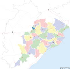
Orissa locator map |
||
| الوصف |
Locator map for the Indian state of w:Orissa. Equirectangular projection - Geographic limits of the map: top=24.27, bottom=17.691 |
||
| تاريخ | |||
| مصدر |
عمل شخصى |
||
| الصانع |
|
||
| سماح (إعادة استخدام الملف ده) |
أنا، صاحب حقوق التأليف والنشر لهذا العمل، أنشر هذا العمل تحت الرخصة التالية: الملف ده مترخص حسب رخصة المشاع الإبداعى نسبة المصنف للى مألفه - المشاركة بالمثل 3.0 العامه
|
||
| Geotemporal data | |||
| تاريخ التمثيل | النصف الثاني من القرن 20 و القرن 21 | ||
| Georeferencing | If inappropriate please set warp_status = skip to hide. | ||
| Archival data | |||
| ملاحظات | Part of WikiProject India Maps | ||
تاريخ الفايل
اضغط على الساعه/التاريخ علشان تشوف الفايل زى ما كان فى الوقت ده.
| الساعه / التاريخ | صورة صغيرة | ابعاد | يوزر | تعليق | |
|---|---|---|---|---|---|
| دلوقتي | 17:28، 6 سبتمبر 2008 | | 2,269 × 2,241 (211 كيلوبايت) | Planemad | |
| 13:28، 21 فبراير 2008 |  | 647 × 564 (132 كيلوبايت) | Mkeranat~commonswiki | {{Information |Description=Locator map for the state of [w:Orissa] updated to show white borders for districts |Source=self-made, based on India locator map by [w:User:Planemad] |Date=Feb 2008 |Author= Mkeranat |Permission= |other_versions= }} | |
| 21:32، 14 فبراير 2008 |  | 647 × 564 (130 كيلوبايت) | Mkeranat~commonswiki | {{Information |Description=Locator map for the state of [w:Orissa] |Source=self-made, based on India locator map by [w:User:Planemad] |Date=Feb 2008 |Author= Mkeranat |Permission= |other_versions= }} |
استخدام الفايل
مافيش صفحات بتوصل للفايل ده.
استخدام الملف العام
الويكيات التانيه دى بتستخدم الفايل ده:
- الاستخدام ف ar.wikipedia.org
- الاستخدام ف as.wikipedia.org
- الاستخدام ف awa.wikipedia.org
- الاستخدام ف ba.wikipedia.org
- الاستخدام ف ceb.wikipedia.org
- الاستخدام ف de.wikipedia.org
- الاستخدام ف en.wikipedia.org
- الاستخدام ف es.wikipedia.org
- الاستخدام ف fa.wikipedia.org
- الاستخدام ف gu.wikipedia.org
- الاستخدام ف hi.wikipedia.org
- नलबण पक्षी अभयारण्य
- साँचा:ओड़िशा के लोकसभा निर्वाचन क्षेत्र
- आस्का लोक सभा निर्वाचन क्षेत्र
- भुवनेश्वर लोक सभा निर्वाचन क्षेत्र
- बलांगिर लोक सभा निर्वाचन क्षेत्र
- कटक लोक सभा निर्वाचन क्षेत्र
- ढेंकानाल लोक सभा निर्वाचन क्षेत्र
- जगतसिंहपुर लोक सभा निर्वाचन क्षेत्र
- जाजपुर लोक सभा निर्वाचन क्षेत्र
- कलाहांडी लोक सभा निर्वाचन क्षेत्र
- कंधमाल लोक सभा निर्वाचन क्षेत्र
اعرض استخدام عام اكتر للملف ده.