
ملف:MSH82 st helens plume from harrys ridge 05-19-82.jpg

حجم البروفه دى: 800 × 541 بكسل. الأبعاد التانيه: 320 × 216 بكسل | 640 × 433 بكسل | 1,024 × 692 بكسل | 1,280 × 865 بكسل | 2,925 × 1,977 بكسل.
الصوره الاصليه (2,925 × 1,977 بكسل حجم الفايل: 3.77 ميجابايت، نوع MIME: image/jpeg)
الخلاصة
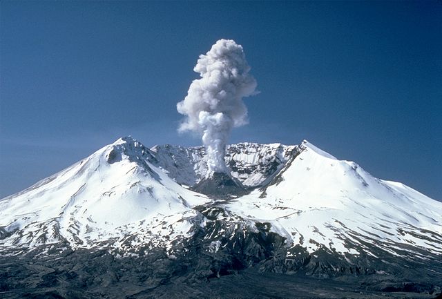
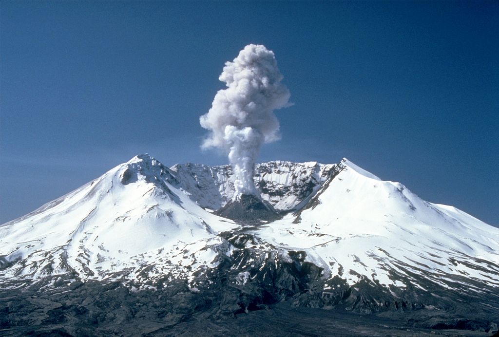
| وصف | Plumes of steam, gas, and ash often occurred at Mount St. Helens in the early 1980s. On clear days they could be seen from Portland, Oregon, 50 mi (80 km) to the south. The plume photographed here rose nearly 3,000 ft (910 m) above the volcano's rim. The view is from Harrys Ridge, 5 mi (8 km) north of the mountain. | |||
| تاريخ | ||||
| مصدر |
CVO Photo Archive Mount St. Helens, Washington Before, During, and After 18 May 1980. |
|||
| مؤلف | Lyn Topinka | |||
| سماح (إعادة استخدام الملف ده) |
|
تاريخ الفايل
اضغط على الساعه/التاريخ علشان تشوف الفايل زى ما كان فى الوقت ده.
| الساعه / التاريخ | صورة صغيرة | ابعاد | يوزر | تعليق | |
|---|---|---|---|---|---|
| دلوقتي | 18:17، 28 نوفمبر 2007 | | 2,925 × 1,977 (3.77 ميجابايت) | CarolSpears | {{Information |Description=Plumes of steam, gas, and ash often occured at Mount St. Helens in the early 1980s. On clear days they could be seen from Portland, Oregon, 50 miles (81 kilometers) to the south. The plume photographed here rose nearly 3,000 fee |
استخدام الفايل
ال1 صفحة دى فيها وصله للفايل ده:
استخدام الملف العام
الويكيات التانيه دى بتستخدم الفايل ده:
- الاستخدام ف af.wikipedia.org
- الاستخدام ف ar.wikipedia.org
- الاستخدام ف ast.wikipedia.org
- الاستخدام ف ba.wikipedia.org
- الاستخدام ف be.wikipedia.org
- الاستخدام ف bg.wikipedia.org
- الاستخدام ف bh.wikipedia.org
- الاستخدام ف bn.wikipedia.org
- الاستخدام ف ca.wikipedia.org
- الاستخدام ف ceb.wikipedia.org
- الاستخدام ف cs.wikipedia.org
- الاستخدام ف cy.wikipedia.org
- الاستخدام ف da.wikipedia.org
- الاستخدام ف de.wikipedia.org
- الاستخدام ف de.wikivoyage.org
- الاستخدام ف el.wikipedia.org
- الاستخدام ف en.wikipedia.org
- Talk:Plate tectonics
- Talk:Volcanic explosivity index
- Mount St. Helens
- Talk:Gabbro
- Talk:Azores
- Talk:Long Valley Caldera
- Talk:Andaman Islands
- Talk:Age of Earth
- Talk:Maui
- Talk:Lanai
- Talk:Easter Island
- Talk:Staffa
- Talk:Mauna Loa
- Talk:Cascade Range
- Talk:Réunion
- Talk:Mount Baker
- Talk:Toba catastrophe theory
- Talk:Pliny the Elder
- Talk:Belcher Islands
- Talk:Mid-Atlantic Ridge
- Talk:Pitcairn Islands
اعرض استخدام عام اكتر للملف ده.