
ملف:Muskegon Michigan harbor entrance.jpg
حجم البروفه دى: 800 × 530 بكسل. الأبعاد التانيه: 320 × 212 بكسل | 640 × 424 بكسل | 1,024 × 678 بكسل | 1,500 × 993 بكسل.
الصوره الاصليه (1,500 × 993 بكسل حجم الفايل: 516 كيلوبايت، نوع MIME: image/jpeg)
| وصف |
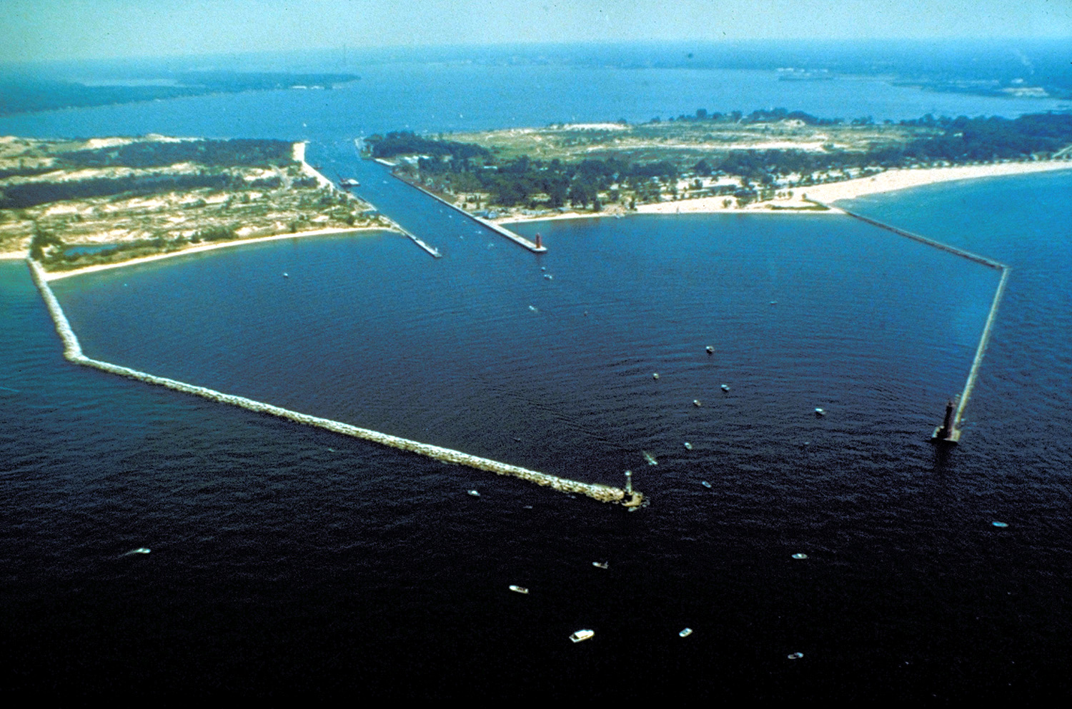
English: The breakwaters and harbor entrance on Lake Michigan at Muskegon, Muskegon County, Michigan, USA. The harbor entrance opens into Muskegon Lake, on which the city is situated. |
|||
| تاريخ | not specified or unknown | |||
| مصدر |
U.S. Army Corps of Engineers Digital Visual Library Image page Image description page Digital Visual Library home page |
|||
| مؤلف | U.S. Army Corps of Engineers, photographer not specified or unknown | |||
| سماح (إعادة استخدام الملف ده) |
|
|||
| الموقع | Muskegon, Michigan, USA |
| موقع الكاميرا | | هذه وغيرها من الصور في مواقعها على: خريطة الشارع المفتوحة |
|---|
تاريخ الفايل
اضغط على الساعه/التاريخ علشان تشوف الفايل زى ما كان فى الوقت ده.
| الساعه / التاريخ | صورة صغيرة | ابعاد | يوزر | تعليق | |
|---|---|---|---|---|---|
| دلوقتي | 01:24، 29 مارس 2007 | | 1,500 × 993 (516 كيلوبايت) | DanMS | {{Information | Description = {{en|The breakwaters and harbor entrance on Lake Michigan at Muskegon, Muskegon County, Michigan, USA. The harbor entrance opens into Muskegon Lake, on which the city is situated.}} | Source = U.S. Army Corps of En |
استخدام الفايل
ال1 صفحة دى فيها وصله للفايل ده:
استخدام الملف العام
الويكيات التانيه دى بتستخدم الفايل ده:
- الاستخدام ف ar.wikipedia.org
- الاستخدام ف be.wikipedia.org
- الاستخدام ف ca.wikipedia.org
- الاستخدام ف ceb.wikipedia.org
- الاستخدام ف ce.wikipedia.org
- الاستخدام ف cs.wikipedia.org
- الاستخدام ف cy.wikipedia.org
- الاستخدام ف dag.wikipedia.org
- الاستخدام ف da.wikipedia.org
- الاستخدام ف en.wikipedia.org
- الاستخدام ف en.wikivoyage.org
- الاستخدام ف eo.wikipedia.org
- الاستخدام ف es.wikipedia.org
- الاستخدام ف eu.wikipedia.org
- الاستخدام ف fr.wikipedia.org
- الاستخدام ف hu.wikipedia.org
- الاستخدام ف ia.wikipedia.org
- الاستخدام ف it.wikipedia.org
- الاستخدام ف ja.wikipedia.org
- الاستخدام ف ko.wikipedia.org
- الاستخدام ف ky.wikipedia.org
- الاستخدام ف lld.wikipedia.org
- الاستخدام ف no.wikipedia.org
- الاستخدام ف pl.wikipedia.org
- الاستخدام ف pt.wikipedia.org
- الاستخدام ف sr.wikipedia.org
- الاستخدام ف tr.wikipedia.org
- الاستخدام ف tt.wikipedia.org
- الاستخدام ف uk.wikipedia.org
- الاستخدام ف uz.wikipedia.org
- الاستخدام ف vo.wikipedia.org
- الاستخدام ف www.wikidata.org
- الاستخدام ف zh-min-nan.wikipedia.org