
ملف:Kuriles Kunashir.PNG
مافيش ريزوليوشن اعلى متوفر.
Kuriles_Kunashir.PNG (365 × 235 بكسل حجم الفايل: 4 كيلوبايت، نوع MIME: image/png)
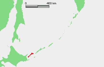
| وصف | Location of Kunashir Island (Кунашир / 国後島), Kuril Islands, Russia | ||||
| تاريخ | |||||
| مصدر | عمل شخصى based on PD map | ||||
| مؤلف | edited by Telim tor | ||||
| سماح (إعادة استخدام الملف ده) |
|
تاريخ الفايل
اضغط على الساعه/التاريخ علشان تشوف الفايل زى ما كان فى الوقت ده.
| الساعه / التاريخ | صورة صغيرة | ابعاد | يوزر | تعليق | |
|---|---|---|---|---|---|
| دلوقتي | 11:01، 3 يوليه 2009 | | 365 × 235 (4 كيلوبايت) | Telim tor | {{Information |Description= Location of Kunashir Island (Кунашир / 国後島), Kuril Islands, Russia |Source= {{own}} based on PD map |Date= 2009-07-03 |Author= edited by Telim tor |Permission= {{PD-Demis}} |other_versions= }} |
استخدام الفايل
ال1 صفحة دى فيها وصله للفايل ده:
استخدام الملف العام
الويكيات التانيه دى بتستخدم الفايل ده:
- الاستخدام ف ca.wikipedia.org
- الاستخدام ف de.wikipedia.org
- الاستخدام ف el.wikipedia.org
- الاستخدام ف eu.wikipedia.org
- الاستخدام ف fr.wiktionary.org
- الاستخدام ف gl.wikipedia.org
- الاستخدام ف nl.wikipedia.org
- الاستخدام ف simple.wikipedia.org
- الاستخدام ف uk.wikipedia.org
- الاستخدام ف www.wikidata.org