
ملف:Hernando de Soto Bridge Memphis.jpg

حجم البروفه دى: 625 × 599 بكسل. الأبعاد التانيه: 250 × 240 بكسل | 501 × 480 بكسل | 801 × 768 بكسل | 1,068 × 1,024 بكسل | 1,500 × 1,438 بكسل.
الصوره الاصليه (1,500 × 1,438 بكسل حجم الفايل: 391 كيلوبايت، نوع MIME: image/jpeg)
| وصف |
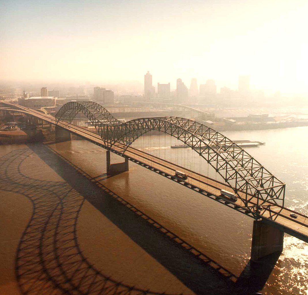
English: Aerial view of the Hernando de Soto Bridge across the Mississippi River between Memphis, Tennessee and West Memphis, Arkansas, USA. The bridge was opened in 1973 and carries six lanes of Interstate-40 across the river. View is from the Arkansas side to the east-southeast across the river to Memphis.
At thumbnail size, image appears clear, at the size on the image page small artifacts can be seen, but at 100% (actual size) the image is heavily artifacted with JPG compression blocks over the entire photograph. |
|||
| تاريخ | ||||
| مصدر |
U.S. Army Corps of Engineers Digital Visual Library Image page Image description page Digital Visual Library home page |
|||
| مؤلف | Larry Donald, U.S. Army Corps of Engineers | |||
| سماح (إعادة استخدام الملف ده) |
|
|||
| الموقع | Memphis, Tennessee, USA |
| موقع الكاميرا | | هذه وغيرها من الصور في مواقعها على: خريطة الشارع المفتوحة |
|---|
تاريخ الفايل
اضغط على الساعه/التاريخ علشان تشوف الفايل زى ما كان فى الوقت ده.
| الساعه / التاريخ | صورة صغيرة | ابعاد | يوزر | تعليق | |
|---|---|---|---|---|---|
| دلوقتي | 01:34، 6 ابريل 2007 | | 1,500 × 1,438 (391 كيلوبايت) | DanMS | {{Information | Description = {{en|Aerial view of the Hernando de Soto Bridge across the Mississippi River between Memphis, Tennessee and West Memphis, Arkansas, USA. The bridge was opened in 1973 and carries six lanes of Interstate-40 across the river |
استخدام الفايل
ال2 صفحة دى فيها وصله للفايل ده:
استخدام الملف العام
الويكيات التانيه دى بتستخدم الفايل ده:
- الاستخدام ف ar.wikipedia.org
- الاستخدام ف ast.wikipedia.org
- الاستخدام ف bo.wikipedia.org
- الاستخدام ف cs.wikipedia.org
- الاستخدام ف de.wikipedia.org
- الاستخدام ف en.wikipedia.org
- Interstate 40
- Talk:List of longest arch bridge spans
- Wikipedia:What is a featured picture?/Examples of technical problems
- Image quality
- Interstate 40 in Tennessee
- Wikipedia:Featured picture candidates/January-2008
- Wikipedia:Featured picture candidates/Image:Hernando de Soto Bridge Memphis.jpg
- Culture of Memphis, Tennessee
- الاستخدام ف en.wikivoyage.org
- الاستخدام ف eo.wikipedia.org
- الاستخدام ف es.wikipedia.org
- الاستخدام ف fa.wikipedia.org
- الاستخدام ف fr.wikipedia.org
- الاستخدام ف fr.wikibooks.org
- الاستخدام ف fy.wikipedia.org
- الاستخدام ف gl.wikipedia.org
- الاستخدام ف gu.wikipedia.org
- الاستخدام ف hi.wikipedia.org
- الاستخدام ف hu.wikipedia.org
- الاستخدام ف id.wikipedia.org
- الاستخدام ف io.wikipedia.org
- الاستخدام ف ja.wikipedia.org
- الاستخدام ف la.wikipedia.org
- الاستخدام ف mr.wikipedia.org
- الاستخدام ف pl.wikipedia.org
- الاستخدام ف ru.wikipedia.org
- الاستخدام ف sh.wikipedia.org
- الاستخدام ف ta.wikipedia.org
- الاستخدام ف th.wikipedia.org
اعرض استخدام عام اكتر للملف ده.