
ملف:Baton Rouge Louisiana waterfront aerial view.jpg
حجم البروفه دى: 750 × 600 بكسل. الأبعاد التانيه: 300 × 240 بكسل | 600 × 480 بكسل | 960 × 768 بكسل | 1,280 × 1,024 بكسل | 1,500 × 1,200 بكسل.
الصوره الاصليه (1,500 × 1,200 بكسل حجم الفايل: 1.04 ميجابايت، نوع MIME: image/jpeg)
| وصف |
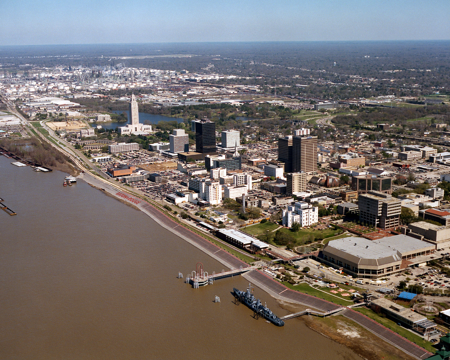
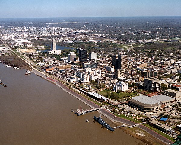
English: Aerial view of the riverfront area of Baton Rouge, Louisiana, USA. The city fronts on the Mississippi River in the center of Louisiana. The tall state capitol tower can be seen at center left. The historic destroyer USS Kidd is moored in the river at the bottom of the picture. View is to the north-northeast. |
|||
| تاريخ | ||||
| مصدر |
U.S. Army Corps of Engineers Digital Visual Library Image page Image description page Digital Visual Library home page |
|||
| مؤلف | Michael Maples, U.S. Army Corps of Engineers | |||
| سماح (إعادة استخدام الملف ده) |
|
|||
| الموقع | Baton Rouge, Louisiana, USA |
| موقع الكاميرا | | هذه وغيرها من الصور في مواقعها على: خريطة الشارع المفتوحة |
|---|
تاريخ الفايل
اضغط على الساعه/التاريخ علشان تشوف الفايل زى ما كان فى الوقت ده.
| الساعه / التاريخ | صورة صغيرة | ابعاد | يوزر | تعليق | |
|---|---|---|---|---|---|
| دلوقتي | 03:05، 6 ابريل 2007 | | 1,500 × 1,200 (1.04 ميجابايت) | DanMS | {{Information | Description = {{en|Aerial view of the riverfront area of Baton Rouge, Louisiana, USA. The ctiy fronts on the Mississippi River in the center of Louisiana. The tall state capital tower can be seen at center left. The historic destroyer U |
استخدام الفايل
ال1 صفحة دى فيها وصله للفايل ده:
استخدام الملف العام
الويكيات التانيه دى بتستخدم الفايل ده:
- الاستخدام ف af.wikipedia.org
- الاستخدام ف an.wikipedia.org
- الاستخدام ف ar.wikipedia.org
- الاستخدام ف ast.wikipedia.org
- الاستخدام ف az.wikipedia.org
- الاستخدام ف bat-smg.wikipedia.org
- الاستخدام ف be-tarask.wikipedia.org
- الاستخدام ف be.wikipedia.org
- الاستخدام ف bg.wikipedia.org
- الاستخدام ف br.wikipedia.org
- الاستخدام ف ca.wikipedia.org
- الاستخدام ف ceb.wikipedia.org
- الاستخدام ف ce.wikipedia.org
- الاستخدام ف cy.wikipedia.org
- الاستخدام ف dag.wikipedia.org
- الاستخدام ف da.wikipedia.org
- الاستخدام ف de.wikipedia.org
- الاستخدام ف de.wikivoyage.org
- الاستخدام ف diq.wikipedia.org
- الاستخدام ف el.wikipedia.org
- الاستخدام ف en.wikipedia.org
- الاستخدام ف en.wikinews.org
- الاستخدام ف en.wikivoyage.org
- الاستخدام ف en.wiktionary.org
- الاستخدام ف es.wikipedia.org
- الاستخدام ف et.wikipedia.org
- الاستخدام ف eu.wikipedia.org
- الاستخدام ف fi.wikipedia.org
- الاستخدام ف fr.wikipedia.org
- الاستخدام ف fr.wikivoyage.org
- الاستخدام ف fy.wikipedia.org
- الاستخدام ف ga.wikipedia.org
- الاستخدام ف gl.wikipedia.org
- الاستخدام ف he.wikipedia.org
- الاستخدام ف he.wikivoyage.org
- الاستخدام ف hsb.wikipedia.org
- الاستخدام ف ht.wikipedia.org
- الاستخدام ف hu.wikipedia.org
اعرض استخدام عام اكتر للملف ده.