
ملف:Egypt - Location Map (2013) - EGY - UNOCHA.svg

الصوره الاصليه (ملف SVG، اساسا 254 × 254 بكسل، حجم الملف: 634 كيلوبايت)
_-_EGY_-_UNOCHA.svg)
الخلاصة
| وصف |
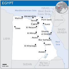
English: Locator map of Egypt. |
| تاريخ | |
| مصدر |
English: Egypt Locator Map (ReliefWeb), ESRI, UNCS |
| مؤلف | |
| SVG منشأ الملف | هذا الرسم المتجهي أُنشئ بواسطة Adobe Illustrator |
الترخيص
- إنت حر:
- فى المشاركه – علشان نسخ و توزيع و بث العمل
- إنك تمزج – فى تكييف العمل
- بالشروط دى:
- نسبه ل – لازم يتنسب العمل للى مألفه بشكل مناسب و توفير رابط للرخصه وتحديد اذا حصلت تغييرات. ممكن ده يتعمل بأى طريقه معقوله، لكن مش بطريقه تشير ان مانح الرخصه بيوافقك على الاستعمال.
 This map is part of a collection of 216 free country maps, created by the UN Office for the Coordination of Humanitarian Affairs (OCHA), to be used in print, web or broadcast products.
The ReliefWeb Location Maps released here are maps that highlight a country, its capital, major populated places and the surrounding regions. Attribution Requirements
Using the map without modifications: ensure that the sources and the disclaimer are below the map. Credit as follows: "Credit: OCHA". For use with alteration: remove the OCHA logo and disclaimer following any modification to the map, but keep the data sources as mentioned below the map. Credit the modified map as follows: "Based on OCHA map". You are responsible for the content of your map. We are keen to receive your feedback and hear how you used OCHA's maps. We would be grateful if you would notify us by e-mail and share your work with us. UN Disclaimer
The designations employed and the presentation of material of this map do not imply the expression of any opinion whatsoever on the part of the Secretariat of the United Nations concerning the legal status of any country, territory, city or area or of its authorities or concerning the delimitation of its frontiers or boundaries. |
تاريخ الفايل
اضغط على الساعه/التاريخ علشان تشوف الفايل زى ما كان فى الوقت ده.
_-_EGY_-_UNOCHA.svg&dir=prev)
_-_EGY_-_UNOCHA.svg&offset=20141209230348)
_-_EGY_-_UNOCHA.svg&offset=&limit=20)
_-_EGY_-_UNOCHA.svg&offset=&limit=50)
_-_EGY_-_UNOCHA.svg&offset=&limit=100)
_-_EGY_-_UNOCHA.svg&offset=&limit=250)
_-_EGY_-_UNOCHA.svg&offset=&limit=500)
| الساعه / التاريخ | صورة صغيرة | ابعاد | يوزر | تعليق | |
|---|---|---|---|---|---|
| دلوقتي | 09:39، 21 مارس 2023 | | 254 × 254 (634 كيلوبايت) | Yoosef Pooranvary | File uploaded using svgtranslate tool (https://svgtranslate.toolforge.org/). Added translation for fa. |
| 08:26، 6 ابريل 2015 |  | 254 × 254 (631 كيلوبايت) | Chronus | Reverted to version as of 06:33, 12 February 2015 | |
| 22:30، 20 مارس 2015 |  | 1,000 × 1,000 (865 كيلوبايت) | Nafsadh | Reverted to version as of 07:31, 10 February 2015: Please do communicate the administration | |
| 22:30، 20 مارس 2015 |  | 1,000 × 1,000 (865 كيلوبايت) | Nafsadh | Reverted to version as of 07:31, 10 February 2015: Please do communicate the administration | |
| 06:33، 12 فبراير 2015 |  | 254 × 254 (631 كيلوبايت) | Chronus | Reverted to version as of 06:46, 24 December 2014 Stop with that! You don't have the right to change the standart! I will comunicate the administration! | |
| 07:31، 10 فبراير 2015 |  | 1,000 × 1,000 (865 كيلوبايت) | Nafsadh | undo unexplained troll revert | |
| 06:46، 24 ديسمبر 2014 |  | 254 × 254 (631 كيلوبايت) | Chronus | Reverted to version as of 08:57, 11 December 2014 | |
| 07:00، 19 ديسمبر 2014 |  | 1,000 × 1,000 (865 كيلوبايت) | Nafsadh | Bir Tawil is named Ma'tan Al-Sarra in Chornus' version. Also UNOCHA colors are not in per of wiki convention | |
| 08:57، 11 ديسمبر 2014 |  | 254 × 254 (631 كيلوبايت) | Chronus | Reverted to version as of 23:53, 18 November 2014 | |
| 23:03، 9 ديسمبر 2014 |  | 1,000 × 1,000 (865 كيلوبايت) | Nafsadh | Halaib Triangle and Bir Tawil |
استخدام الفايل
مافيش صفحات بتوصل للفايل ده.
استخدام الملف العام
الويكيات التانيه دى بتستخدم الفايل ده:
- الاستخدام ف en.wikipedia.org
- الاستخدام ف id.wikipedia.org
- الاستخدام ف incubator.wikimedia.org
- الاستخدام ف mdf.wikipedia.org
- الاستخدام ف nia.wikipedia.org
_-_EGY_-_UNOCHA.svg)